The administrative boundary map is a very important tool in today's life. This is a type of map that shows the border or boundary of an area or territory on a map. How is the Pope's map different from the administrative map? If the Pope's map is implemented on the digital map platform, what benefits will it bring? Please refer to the article below with IOTLink!
What is an administrative geographic map?
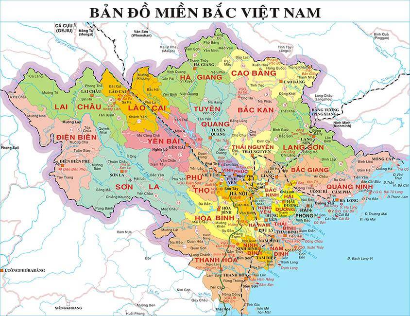
Is a type of map showing the boundaries, dividing administrative units and marked by landmarks. This map is the legal basis for the division and regulation of the scope of responsibilities of the state administrative apparatus at all levels. From there, manage the economic, political, social, cultural, land and population factors of a locality.
Contents of administrative geographical map
The road element is the most basic content shown on the Pope's map. Edited based on existing topographic maps.
The Pope's map should clearly show:
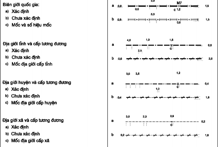
- Boundary landmarks: usually placed in conspicuous places on the field, must be fully displayed on this map.
- Crossing points, turning points, curving points, curvilinear crests: usually shown in roads, ditches, canals, etc. Especially, they must be clearly and accurately shown on commune-level maps. As for the map at district and province level, it is possible to generalize.
The role of administrative geographical maps in life
It must be said that this type of map is very important. It is not only used to manage land, but also to determine political power within the administrative sphere.
Geolocation
Clearly define the geographical location and boundaries of administrative units. Helping to better manage and protect land and resources and develop socio-economically.
Determining the scope of administrative management
Clearly define the scope of administrative management of the units from the provincial to the commune level.
Increased accountability and transparency
As a tool to help manage and develop land and resources in an open, transparent and responsible manner.
Supporting urban and rural planning
This is also a tool to help locate projects, determine scope, urban and rural planning. From there, the management and development of the area is more accurate.
Differences between administrative map and administrative boundary map
Administrative map and pope map are both important documents related to land scope in administrative management. They have the following differences:
About the intended use
- HC Map: Description of administrative units, lands and population.
- Map of the Pope: Describing geographical boundaries and boundaries between administrative units.
About geographic objects
- HC map: Shows administrative units of provinces, cities, districts, communes, ...
- Pope's map: Shows the boundaries of the geographical scope of a particular administrative unit.
About the scope of use
- HC Map: Used for planning, management and development orientation purposes of administrative units.
- Pope map: Used for the purpose of helping scientists, researchers, etc. better understand the geographical features of a particular area.
>>> See more Basic knowledge about administrative map of Vietnam
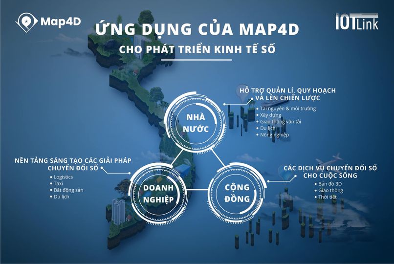
If the Pope map is combined on the digital map platform?
If there is a combination of the above combined Pope map digital map platform will improve the identification of information, management.
- Boundary extents will be generated with higher precision density.
- High precision positioning technology.
- Satellite imagery and digital maps provide visual representation.
- Information about land, resources, population, etc. helps to manage effectively and comprehensively.
- Ability to search and retrieve information quickly.
- Manage geographical area, administrative area more effectively.
In short
Administrative boundary map is an important type of map in the field of land and resources in Vietnam. It is an important tool and can be applied in many people's lives. Both the HC map and the Pope map are useful for the study, management and development of each area. Improve people's living standards and develop the country.