Solution
by map4d
The map4d digital map platform provides solutions for the management and digital transformation of the government such as urban planning, agriculture, forestry and fishery, population management, industrial clusters, tourism, and infrastructure. Passive power and telecommunications grids, environmental resources,...
map4d
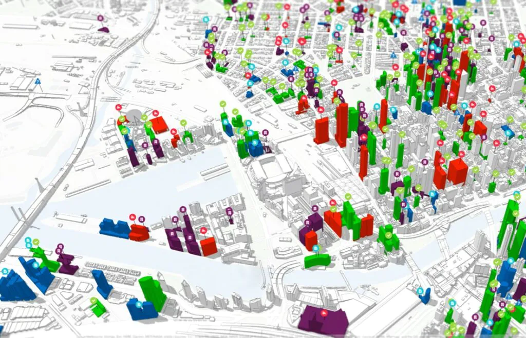
The 4D digital map is an update of the current state of the 3D digital map over time. Map4D GIS Platform provides APIs/SDK services for logistics, e-commerce and other commercial industries related to digital maps.
MAP4D PLATFORM
– Provide 2D digital map platform.
– Provide 3D digital map platform.
– Provide a 4D digital map platform (in the time dimension) for application in urban planning.
– Ability to integrate data layers on the map platform.
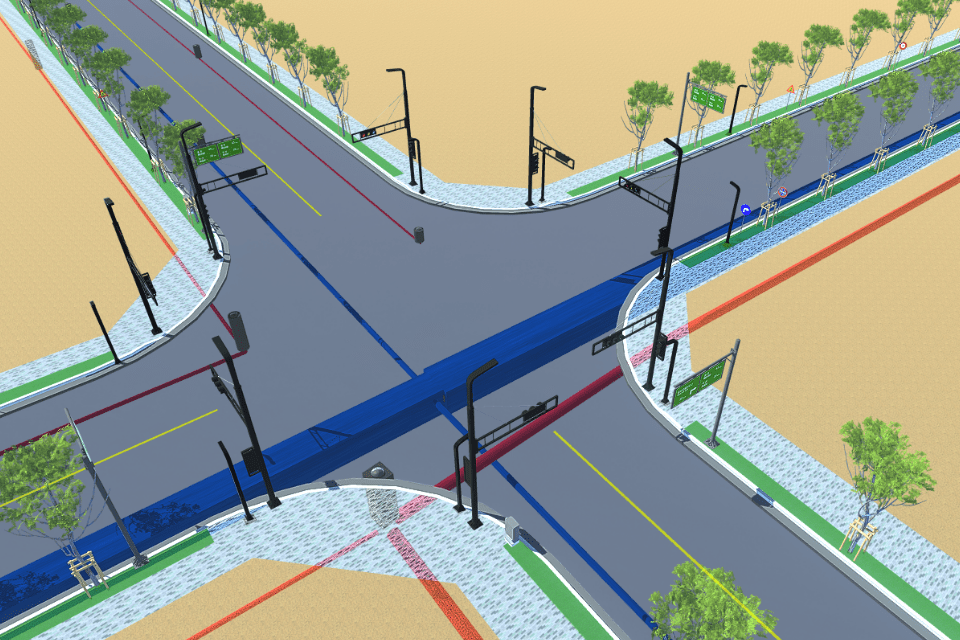
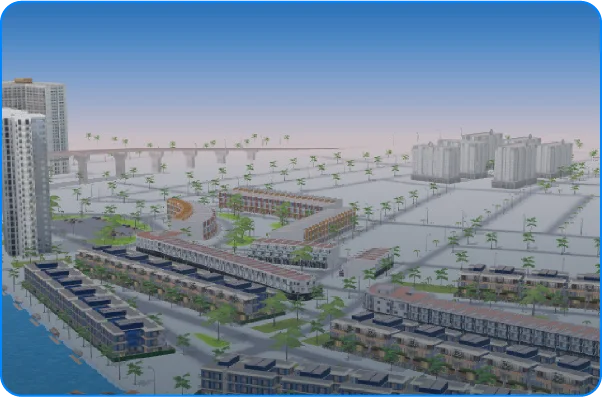
URBAN PLANNING
– Provide tools to systematize the planning database
– Provide urban technical infrastructure management software
– Provide a system to provide information on planning and management of technical infrastructure based on GIS

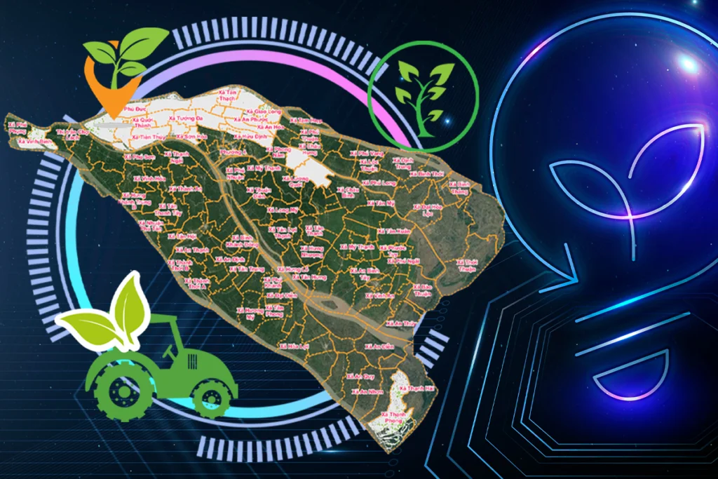
AGRICULTURE
– Display information about the basic management object.
– Display the plot of land for cultivation on digital and satellite maps.
- Statistics of planting area of each cooperative, land plot, region, type of crop
– Relevant reports on area, type, productivity, output, input value
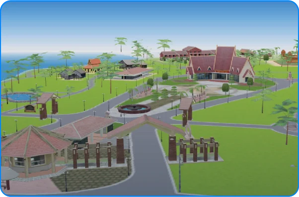
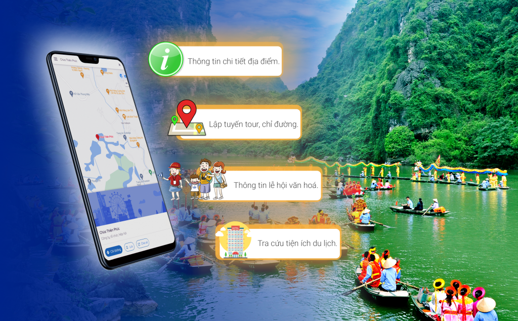
VĂN HOÁ DU LỊCH
- Provide a system to look up tourist information and guide tours for visitors.
- Tourism promotion module with 3D map platform allowing integration of new technologies such as: VR 360, Live Camera, AI camera, senser...
– Operation management module for and providing full functions of updating tourist information, decentralization…
MANAGEMENT OF INDUSTRIAL Clusters
- Management of technical infrastructure.
- Managing the operation of the Industrial zone.
- Management of planning of industrial clusters.
- Introduce the current planning status to the investor.
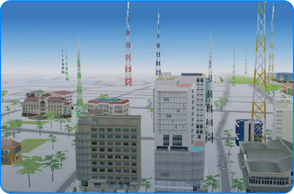
MANAGEMENT PASSIVE TELECOMMUNICATION INFRASTRUCTURE
- Provide a system to look up information about facilities: Agency, equipment station, path, density, ...
– 3D map allows the integration of new technologies such as: VR 360, Live Camera, AI camera, senser… to help the management unit intuitively in management.
– Operation management module for and providing full functions of updating tourist information, decentralization…
TÀI NGUYÊN MÔI TRƯỜNG
– Manage resource allocation and exploitation
– Status management
– Monitoring climate change and land use
- Environmental planning management
DU LỊCH THÔNG MINH (SMART TOUR)
– Tích hợp nhiều nền tảng công nghệ hiện đại và dữ liệu liên tục.
– Mang đến bộ giải pháp tổng thể, toàn diện dành cho cả 3 đối tượng: Người dùng – Tổ chức/Doanh nghiệp – Nhà quản lý.
– Operation management module for and providing full functions of updating tourist information, decentralization…
PHẦN MỀM KHO DỮ LIỆU DÙNG CHUNG TRÊN NỀN CÔNG NGHỆ DỮ LIỆU LỚN (MapHub)
– Giao diện nhất quán và dễ sử dụng cho phép người dùng không chuyên chia sẻ dữ liệu và tạo bản đồ tương tác.
– Phân hệ công cụ tích hợp dữ liệu bản đồ
– Phân hệ dịch vụ chia sẻ dữ liệu bản đồ
– Phân hệ Dashboard
SỐ HOÁ 3D VÀ QUẢN LÝ HẠ TẦNG NGẦM
– Cung cấp bản đồ nền chuyên biệt cho các công trình ngầm.
– Số hoá 3D và trực quan các hệ thống công trình ngầm phục vụ công tác điều hành, quản lý, quy hoạch xây dựng,..
– Liên kết dữ liệu mặt đất và ngầm. Hỗ trợ công nghệ VR nhằm mục đích dễ dàng nhận diện và kiểm soát hạ tầng ngầm.