A map (also known as a map) is an exact thumbnail of objects about an area, country or the whole Earth. So do you know what is the mapping and mapping term in Vietnam? Let's refer to IOTLink's knowledge below to understand more information!
What is mapping?
Mapping means a descriptive term for the collection and aggregation of data. For example: geographic information system, data of parcels, plot boundaries, cadastral, address, location information, spatial data fields, population, roads, canals, rivers, seas, etc. then apply the method of digitizing that data, and then re-rendering it into a digital map platform. We can understand it roughly, mapping is a descriptive term about creating maps, digital maps.
What is Data Mapping Vietnam?
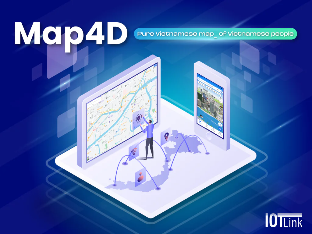
Data Mapping Vietnam is a collection of Vietnam map data into a centralized database. The Vietnam mapping process is mandatory for data migration, data entry, processing and management. After all, the goal of Data Mapping Vietnam is to align the data sets on the map of Vietnam with a common standard of the current state (NGSP and LGSP standards), to become the homogeneous data set of the country. And that's also what the digital map platform Map4D has been and is being implemented.
Business develops, country develops. From there the amount of data and the complexity of the system. As well as the mapping process becomes complex and requires high technology, more advanced, continuously updated and more extensive. Therefore, it can be seen that Data Mapping Vietnam is a very necessary activity to provide data for business purposes.
What advantages does Vietnam mapping data have for businesses?
Digital transformation and advanced transformation tools can help businesses exploit more data while saving time and budget. In particular, the Vietnam mapping data shown on the map shows that the data fields of the business will be displayed in the most intuitive and detailed way.
IOTLink with Vietnam mapping data is visualized in 3D and 4D time dimension. Helping businesses to thoroughly evaluate the investment, project implementation or planning scale, etc. With the most accurate profitability and development.
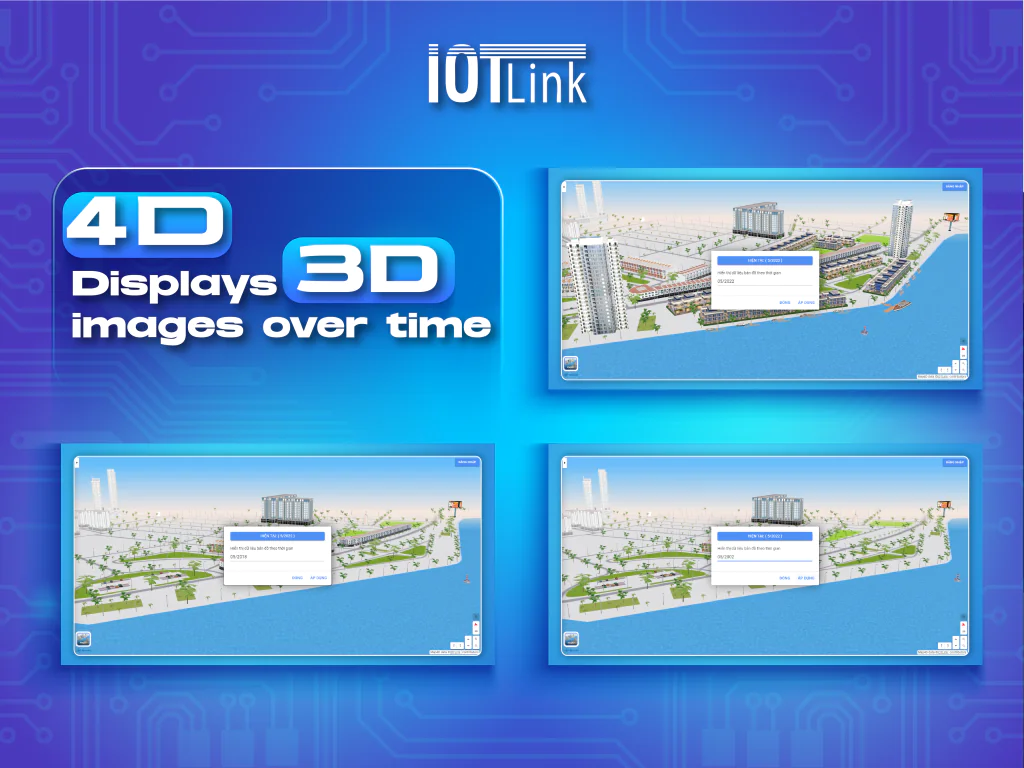
Specific examples: In the past, when implementing a certain project, businesses or organizations had to record data on paper and store it. Such data can be considered accurate at that time. However, the country is developing more and more, the data is more and more and the system becomes more complex. However, the data on paper will not be able to keep up with the speed and will be constantly changing. Therefore, mapping data of businesses on the map of Vietnam will be the most effective method.
Emphasize transparency
Because the data of businesses on the map is important, accurate in time, data source, destination and quality. Therefore, Vietnam Mapping data will provide accurate, intuitive, transparent and up-to-date data quickly.
Complex data optimization
Map4D's Vietnam Mapping service can be integrated on different applications and platforms. So the data provided by the enterprise can be converted accurately, saving time and data processing will no longer become a difficult problem.
Easier data modeling on the map
Data mapping is not a quick fix. But after the enterprise's data is updated on IOTLink Map4D with Vietnam data mapping, it will reach more people. Since then, it has brought many effects such as: intuitive business model, detailed and accurate business data, tracking the progress of enterprise projects, etc.
Better data management
The map data of the business will be a very important part of the construction and maintenance. Good enterprise data, reach more people, business process, operations grow stronger in the future.