View online satellite maps with street images from above, giving you new images and data. With today's strongly developed technology, even in one place you can see other places with real images. Join IOTLink to learn about satellite maps and how to use them on Map4D!
What is satellite map?
The geodesy is created from images taken of the earth's surface from space by artificial satellite equipment. Then, this image is synthesized and created BDOT.
This map is commonly used to show landmarks, terrain, and natural environments around the world. It provides users with a clear view of specific locations, as well as overall aspects of the Earth, such as topography, geology, oceans, and the surface of the continents.
Important applications in various fields. Includes science, geography, geology, resource exploration, and environmental management.
Advantages of viewing satellite maps
Give viewers an overview of an area. Understand the geographical structure, topography of that area.
We can easily access the Internet and see the exact satellite images of the terrain and geology that we are looking for.
Can locate and navigate the map. Like other interfaces, this display also identifies where you are and gives directions.
The actual image of the location can be viewed. Suitable for travel and outdoor activities. Provide information about tourist attractions, sightseeing. Help users plan their trip. Travel, sightseeing is safer and optimize the time and cost of the trip.
Support in environmental work and scientific research. Provide accurate information about terrain, environment, climate, vegetation and other lands. Help scientists and environmental managers can research and evaluate. And monitor lands and environments more accurately and efficiently.
How to use satellite maps on Map4D
IOTLink will guide you to view the geodesy on Map4D using a computer device with simple steps as follows:
Step 1: You access Map4D's Website: https://map.map4d.vn/
Step 2: Search the place you want to search
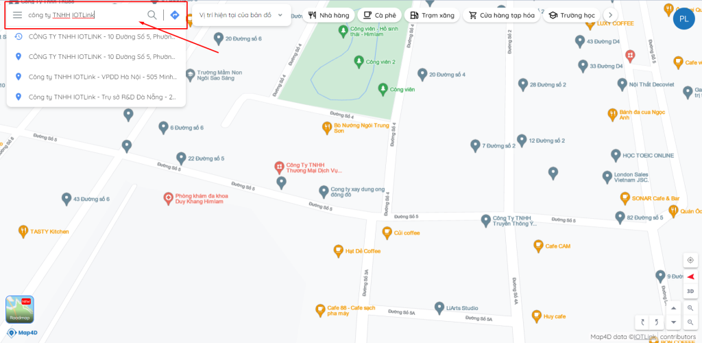
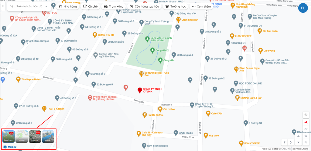
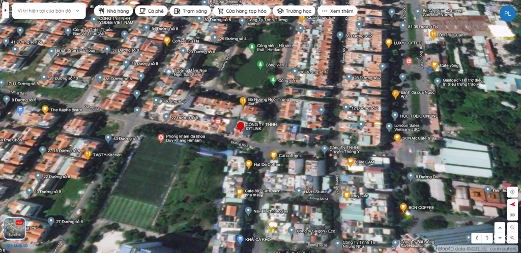
Step 3: Click to select the type of map you want to see. Here we want to see the satellite map, click on Satellite to display the map as a satellite!
You can also use Map4D on your smartphone device.

In addition to the BDTV interface, you can also view objects in different forms. Include:
- Roadmap: Map with 2D data displayed in software vector form.
- Satellite: Display satellite image map
- Map3D: Map displays as visual 3D images
- Raster: Map with 2D data displayed in pixels (images)
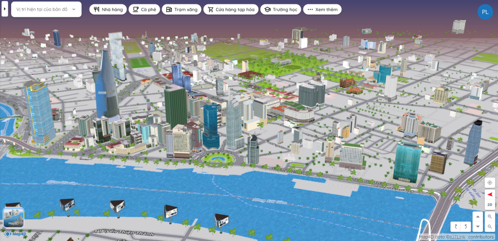
Visual 3D map images on Map4D
In Map4D there is a special feature, you can view the object image on the map as a visual 3D model. From there you can clearly visualize the location you want to know.
In short
To be able to view satellite maps on the territory of Vietnam, it is necessary to update continuously. This is an element that Map4D always appreciates. Regularly update the map to bring users the latest and most optimal data platform. Also thanks to this map you can learn to new places that you have never been to. Experience the digital map on Map4D right now!