Dịch vụ bản đồ Map4D hiển thị bản đồ số 2D, 3D và 4D (hiển thị hình ảnh 3D theo chiều thời gian) đầu tiên và duy nhất tại Việt Nam.Với các bộ APIs tiện dụng, Map4D mang đến những tính năng tiện lợi như tìm kiếm các địa điểm, đường đi, gợi ý tuyến đường thông minh, chia sẻ vị trí… nhanh chóng, chính xác. Cùng IOTLink tìm hiểu về Map4D qua bài viết dưới đây nhé!
Map4D . map service
Map4D with accurate 2D data, continuously updated visual 3D images, incorporating time-dimension 4D technology. Is a plus point for Map4D to accompany businesses in managing and upgrading customer experience.
Not stopping there, with the ability to connect many modern software, platforms, and technologies… Map4D allows the development of new applications to meet the practical and specialized needs of each business.
Typical solutions of Map4D . map service
Map4D . Solution
Call a car, deliver goods
Provide sets of APIs/SDKs about locations, routes, routes, etc., which are immediately integrated into the platforms, websites, and software of the enterprise that are currently in use or for the needs of developing new 3rd party applications.
- Make a travel route.
- Suggest the most convenient route.
- Location details.
- Predict the exact travel time.
- Improve customer experience…
Chain system
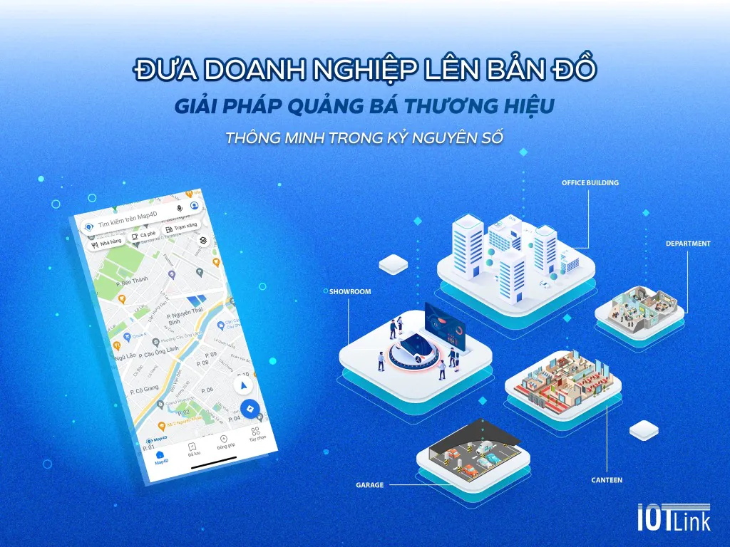
Visualize your chain of stores. Put your business image on the digital map quickly. Drive revenue, increase conversion rate, increase brand awareness, easily reach customers.
- Provide APIs: Direction, Autosuggest, Geocoding, Place search, etc.
- Provide Map4D SDK, Map Service SDK.
- Programming service to embed Map4D applications on Web or App on Mobile.
- Built-in face recognition AI camera.
Enterprise and industrial infrastructure management
Helping businesses and industrial parks manage their infrastructure. Know the quantity, location, scale, operational status, etc. of technical assets and equipment. Integrated on multiple platforms, easy to access information, effective reporting.
- Provides Map4D API/SDK.
- Provide VR360 technology.
- Integrated AI camera system, AI sensors, …
Real estate management
Helping real estate businesses solve the problem of "visiting the project at home" of customers but still bringing high efficiency. Businesses can provide full information of real estate projects and customers can easily learn and understand the information in the shortest and most convenient time.
- Provide Map4D SDK, Map Service SDK.
- Programming service to embed Map4D applications into Web or App on Mobile.
- Integrated AI camera, operating management, infrastructure management.
- Provide React SDK, Vr360.
Government Solutions
Map4D Platform
- Provide 2D, 3D digital map platform.
- Provide a 4D digital map platform (in time dimension) for application in urban planning.
- Ability to integrate data layers on the map platform.
Urban planning
- Provide tools to systematize the planning database.
- Provide software for urban engineering and infrastructure management.
- The system provides information on planning and management of technical infrastructure based on GIS.
Agriculture
- Displays information about the basic managed object.
- Hiển thị thửa đất, vùng trồng trọt trên bản đồ số và vệ tinh.
- Statistics on planting area of each cooperative, land plot, region, type of crop.
- Relevant reports on type, area, productivity, output, and input value.
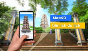
Traveling culture
- Provide a system to look up tourist information and guide tourists.
- The tourism promotion module with a 3D map platform allows the integration of new technologies such as: VR 360, Live Camera, AI camera, senser...
- The operation management module provides a full range of functions to update tourist information, decentralize...
Management of industrial parks
- Technical infrastructure management.
- Management of industrial zone activities.
- Planning management of industrial clusters.
- Introduce the current planning status with the investor.
Passive telecommunications infrastructure management
- Provide a system to look up information about facilities: Agency, equipment station, path, density, ...
- Mô hình 3D cho phép tích hợp công nghệ mới như: VR 360, Camera AI, Camera live, senser… giúp đơn vị chủ quản trực quan trong công tác quản lý.
- The operation management module provides a full range of functions to update tourist information, decentralize...
Environmental Resource Management
- Manage resource allocation and exploitation.
- Status management.
- Monitor climate change and land use.
- Environmental planning management.
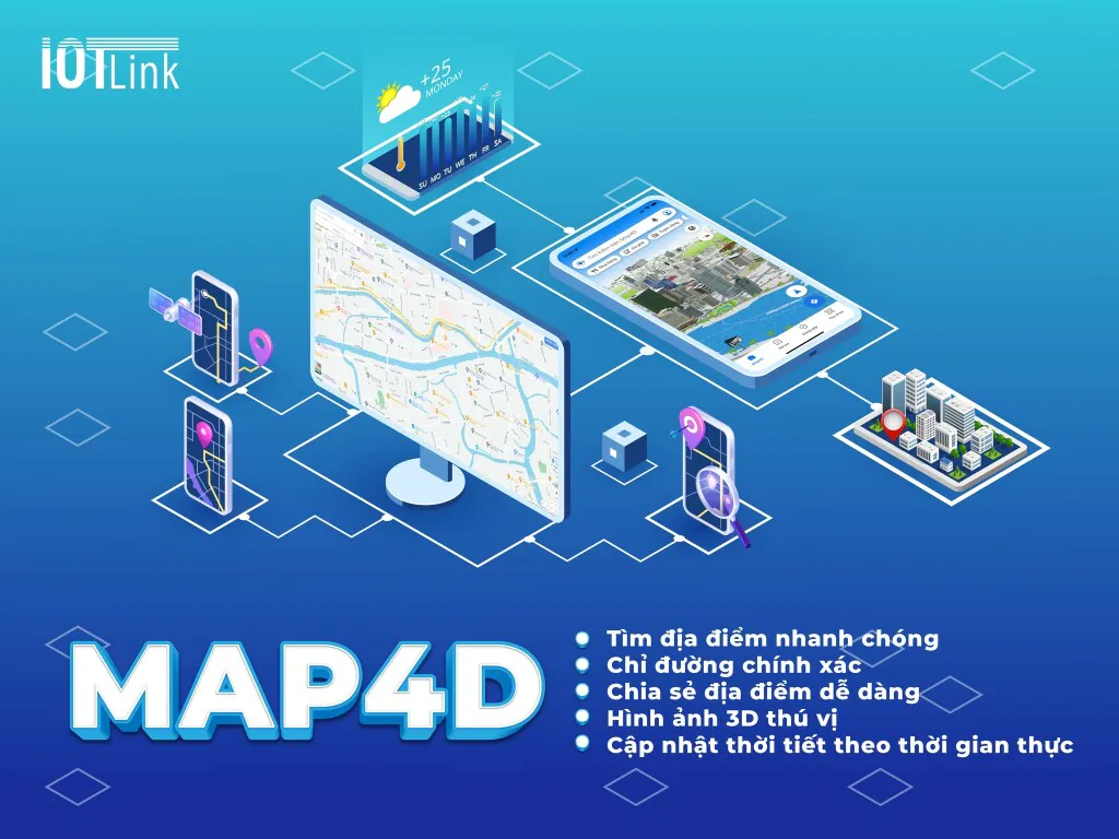
Lợi ích khi sử dụng dịch vụ bản đồ Map4D
- Update data continuously.
- Simulate objects displayed in 3D.
- See the change of each area, project, etc. in the past, present and future.
- Headquartered in Vietnam, fast support service.
- Flexible security divided by many levels.
- Compatible on many platforms: Web, App, Mobile, iOs, Android, Flutter, React,…
Bảng giá của dịch vụ Map4D
We offer flexible optional service packages for businesses.
>>> BIG OFFER: 1,000 downloads from only 93,000 VND <<<
Map4D was developed by Vietnamese engineers of IOTLink with the advice of experts from the world's leading technology corporations.
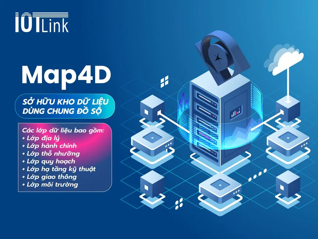
IOTLink cung cấp gói dịch vụ bản đồ số dùng chung, đáp ứng nhu cầu sử dụng của các dự án của các tỉnh, các thành phố, các doanh nghiệp, mang đến giải pháp hiệu quả, tiết kiệm chi phí.
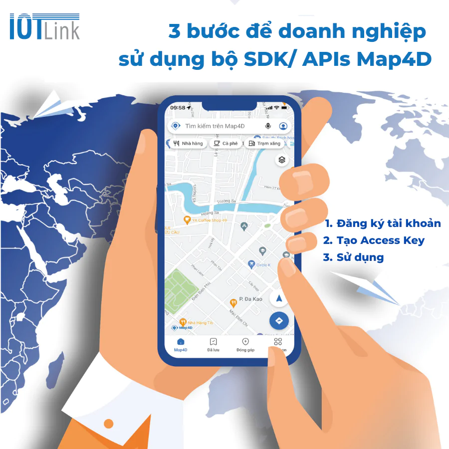
3 easy steps using Map4D . APIs/SDK set
Map4D support 2D data, 3D data, and effects of day and night, weather... The special thing is that all data on Map4D can be dynamically represented in time (4D) to serve for planning problems. , or actual data on the map.
To use, businesses only need to follow these 3 steps
- Step 1: Register an account on Map4D.
- Step 2: Generate Access key.
- Step 3: Use map tools and services.
Map4D Platform is a digital mapping platform that provides toolkits (SDKs) and services (APIs) for developing and building digital map-related applications.