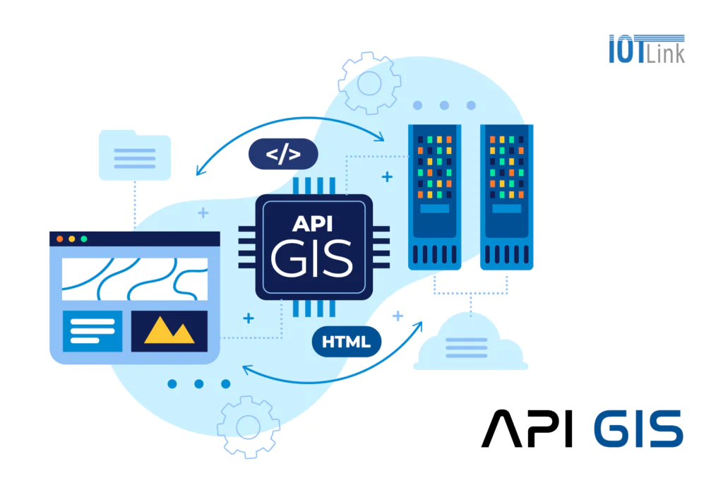
The GIS API is Application Programming Interface – Geographic Information System. An application programming interface that allows developers to use geographic information system (GIS) services and functions in other applications and technologies.
Mobile application
The GIS API allows the integration of geographic information into mobile applications.
*** For example, a digital map application like Map4D uses the GIS API to display geographic data, search for places, calculate routes, and provide location-related features.

IoT (Internet of Things)
When combined with IoT devices, the GIS API enables geographic data to be retrieved from sensors and different data sources for geographic information analysis and visualization.
*** For example, in an environmental monitoring system, can be used to display sensor data directly on the map.

Artificial intelligence and machine learning
Provides the ability to integrate geographic data into artificial intelligence (AI) and machine learning (Machine Learning) models. This enables AI and Machine Learning applications to use geographic information to analyze, predict, and make intelligent decisions.
*** For example, in telecommunications, GIS APIs can be used to analyze geographic data and predict future network health.

Resource and environment management
GIS APIs are widely used in environmental and resource management applications.
*** For example, in urban management, the GIS API allows the assessment and analysis of geographic data to:
- Infrastructure management.
- Urban development plan.
- Water resource management.
- Forest management.
- Environmental impact assessment.
- And many other fields.
Weather forecast
The GIS API can integrate geographic data and weather data. Provides local weather forecast and visual display of weather information on the map. This is useful in weather analysis and forecasting for applications such as tourism, agriculture, marine and emergency management.
Urban planning and development
The GIS API supports urban planning by providing tools for geographic analysis, geographic information visualization, and geographic computation. As a result, urban planners and managers can use the GIS API to make decisions based on geographic information and assess the impact of development plans.
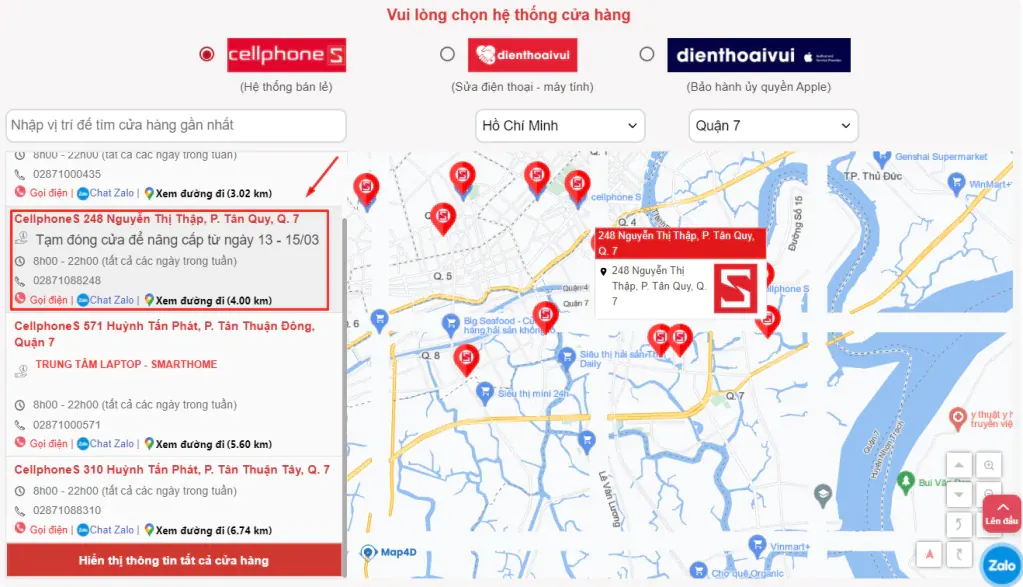
Online and e-commerce
The GIS API can be used to integrate geographic information into e-commerce and online applications.
*** For example, a brand website can use the GIS API to display retail branch locations and related information. Such as sales time, contact hotline, travel distance, time to the store...
Transport and navigation systems
The GIS API is used in navigation and transportation applications to:
- Route optimization.
- Vehicle location tracking.
- Provides navigation instructions.
- Provide traffic information.
*** For example, bus locators or motorcycle locators use GIS APIs to display location and provide route information. Or integrated on Map4D digital map. Bringing users the most optimal route map solution.

In short
GIS APIs play an important role in integrating geographic information into other technologies. Open up a variety of opportunities and applications in different fields. Such as mobility, IoT, artificial intelligence, e-commerce, environmental and resource management, urban planning, transportation and positioning….