Planning map is a type of map that anyone must understand if entering the field of real estate and real estate. The inspection of planning before and after buying and selling land or building projects is extremely important. Ensure the interests of investors, avoid wasting money and time. Join IOTLink to refer to the article below to know more about the planning map.
Concept of planning map
According to the provisions of Clause 14, Article 3 of the Law on Planning 2017 – effective from January 1, 2019
"Planning diagrams and maps are drawings showing planning contents".
In Article 3 of the 2013 Land Law, it stipulates:
“Land use planning map is a map made at the beginning of a planning period, showing the distribution of land types at the end of that planning period”.
In a nutshell, the master plan is a type of map that divides and identifies according to the specifications of the urban planning land. Based on the requirements of the management of architecture, landscape, layout of technical and social infrastructure works, in order to concretize the content of the master plan or subdivision.
Based on this type of map, the viewer can see the status of the land plots for common use throughout the area. When a project starts planning, everything on that land will be removed, so people can rely on this map to review and make decisions about investment, land purchase, and house purchase. .
Why is the planning required to have a map?
- According to the law, planning is required to have a map. It is clearly stated in the legal documents and has been promulgated.
- There are many types of maps used, depending on the period and land use purpose.
- The planning project is the element expressing the urban planning content. Including models, drawings, explanations, management regulations according to urban planning (according to Clause 6, Article 3).
Types of BDQH
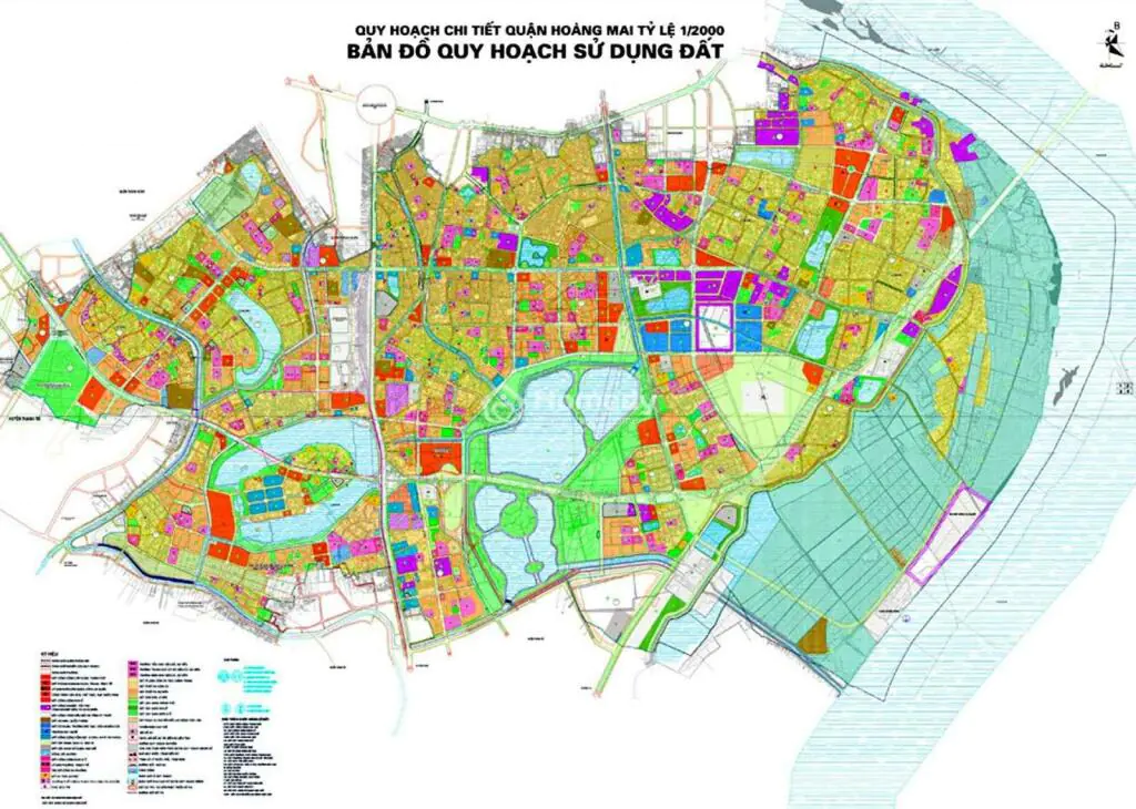
Currently, there are 3 types of planning maps. It is a planning map of 1/5000, 1/2000 and 1/500 scale.
1/5,000 scale planning map
- Task: Is a map that clearly identifies boundaries, landmarks, traffic, functional areas of land for infrastructure development and social security such as roads, electricity, bridges, culverts, areas residential, school, hospital, park, etc.
- Purpose: Determining development goals, calling for investment, site clearance, immigration, compensation, etc.
Planning map at the scale of 1/2000
- Tasks: As a division map, from which to determine the land use function, to build a network of infrastructure works. This map can concretize urban planning content.
- Purpose: Orienting urban planning, developing and managing a large area in the future.
Planning map scale 1/500
- Mission: Is a map showing details of construction elements on the land.
- Purpose: To be considered as the master plan document of the investment project. Besides, it is also considered as the basis for locating, designing, constructing and developing works.
How to look up planning information
Currently, each province and city has its own specific regional council. If you need to see the PO in the exact area you are interested in, just make an application and submit it to the relevant authorities, responsible authorization levels. From there you can view information about the land or area you want to learn.
In addition, in the modern technology era, some provinces or real estate businesses will have their own websites to provide specific POs, serving viewers conveniently and quickly.
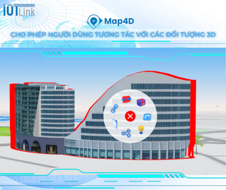
Map4D – Providing smart project solutions on digital maps
Map4D is the first and only digital map in Vietnam capable of combining three-dimensional space with smart technology applications to reproduce a vivid panorama in linear time (Past - Present). – Future) – ushering in a breakthrough in the 4.0 revolution.

Under the operation and development of a team of IOTLink technology engineers, Map4D is increasingly perfecting and deepening into people's lives, supporting the Government and businesses in digital transformation.
With Map4D, businesses provide full project information to customers. And customers easily understand the project, grasp the profitability, make the right decision.
- Updating and analyzing data continuously brings high accuracy.
- Draw a vivid "map picture" on the basis of: Coordinate axis - 3-D space - Time.
- Wide application: State management, urban planning, logistics, tourism...
- Easy to use with the ability to connect to a wide range of SDKs/APIs.
- The database is located in Vietnam. The information security system meets level 3 information security standards.