Seaport maps play an important role in many areas of business activities. See the map you know each seaport location in Vietnam and the world. Let's find out information about Vietnam seaport map with IOTLink!
What is a seaport map?
A seaport map is a type of map used to show the seaport locations in a particular area or country. It is also an important tool in the management and development of seaports. Enables port managers to effectively assess, plan and manage port resources.
What does the map of Vietnam's seaports show?
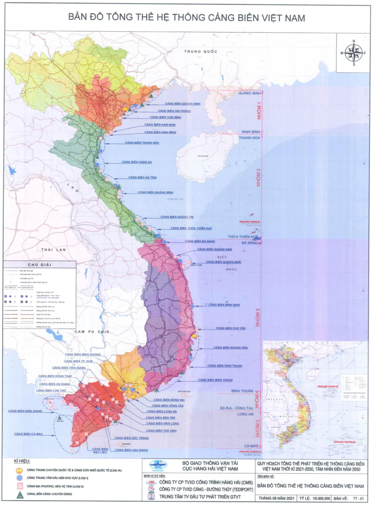
The map of Vietnam's seaports shows Vietnam's seaports and their geographical locations on the Vietnamese coast. This map provides users with information on the arrangement and distribution of seaports in the country. Including large and small ports.
Besides, this map also provides information for viewers. Including the name, location, size, function, ... of each seaport. Providing sea routes, sea management areas and exclusive seas and islands of Vietnam.
Researchers and analysts can view this map as a tool for assessment and management. Proposing strategies for investment and development of Vietnam's seaports in the future.
How many seaports does Vietnam have?
Based on the criteria of the scope of influence of the seaport and the criterion of the size of the seaport. Seaports in Vietnam are assessed and classified into 4 categories as follows:
- Special seaports: Hai Phong seaport and Ba Ria - Vung Tau seaport.
- 11 seaports of class I: Quang Ninh seaport, Nghe An seaport, Thanh Hoa seaport, Ha Tinh seaport, Da Nang seaport, Quang Ngai seaport, Khanh Hoa seaport, Binh Dinh seaport, Dong Nai seaport , Ho Chi Minh City Seaport, Can Tho Seaport.
- 7 seaports of class II: Quang Tri seaport, Quang Binh seaport, Binh Thuan seaport, Thua Thien Hue seaport, Hau Giang seaport, Dong Thap seaport and Tra Vinh seaport.
- 14 seaports of class III: Thai Binh, Nam Dinh, Phu Yen, Quang Nam, Ninh Thuan, Long An, Binh Duong, Tien Giang, Soc Trang, Ben Tre, An Giang, Vinh Long, Kien Giang, Ca Mau.
The role of the map of Vietnam's seaports
Vietnam's seaport map plays an important role in many areas related to seaports and waterways.
- Provide information about seaports of Vietnam. Includes location, size, function and name of domestic seaports. Helps users have an overview of Vietnam's seaports.
- A useful tool for port managers to assess, plan and manage port resources.
- Vietnam's seaport map helps sailors and port staff operate more safely and efficiently at sea.
- Provide relevant investors and businesses with information about the port. Make strategic decisions on investment and development.
- Support trade, export, import and other economic activities related to waterways.
- Management and protection of the marine environment. Help local authorities implement policies and regulations related to seaports.
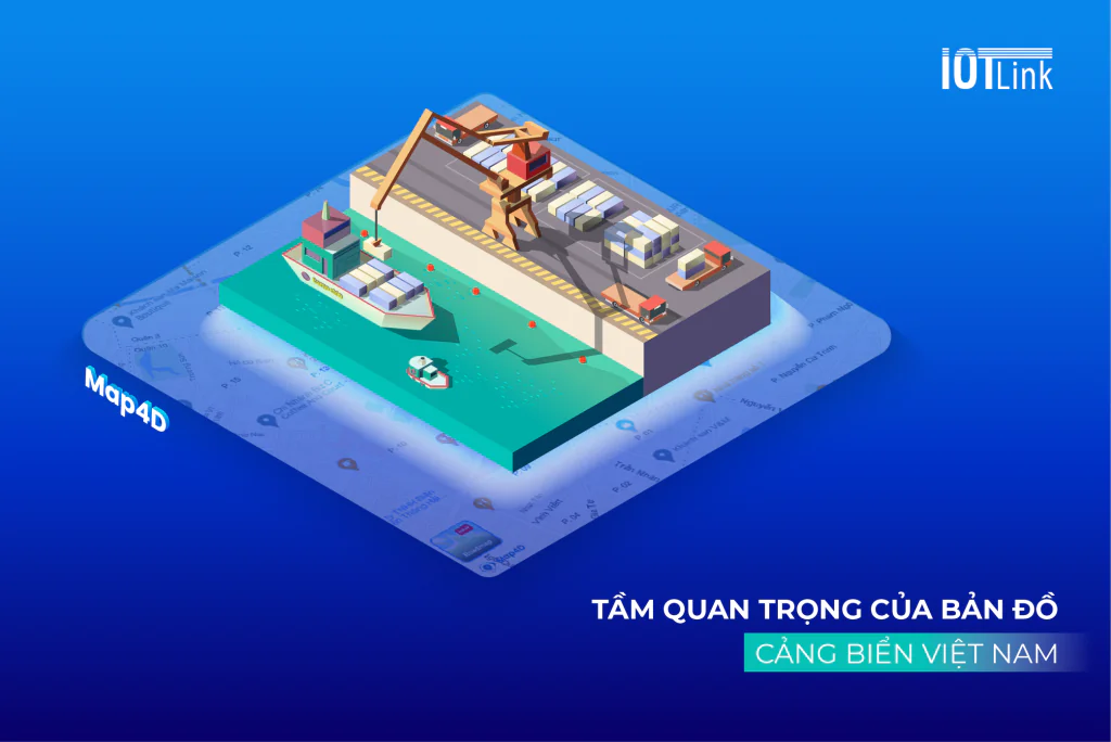
Map4D platform brings benefits to Vietnam's seaports
Digital map platform Map4D with massive digitized data. Visual interface displays 3D and 4D time dimension. Bring many applications and benefits to serve Vietnam's seaports.
Help manage and operate the seaport more efficiently
The digital map provides complete and accurate information about the location of ships, berths, equipment and cargo status at the ports. This makes it possible for Vietnamese seaport managers to monitor. Control port operations accurately and efficiently.
Enhance security and safety for seaports
Digital maps can help protect and detect unusual or dangerous activities in the port area. At the same time, helping those involved in seaport activities. Includes crew and port staff. Easily control and manage the movement status of ships and goods in the port area.
Optimizing logistics and freight operations
Can help freight units optimize routes and delivery times. Minimize waiting time and speed up freight.
Support in seaport development planning
Digital maps provide detailed and accurate information about port infrastructure and resources. This helps those involved in seaport development planning to make reasonable and correct decisions. Improve the efficiency and competitiveness of Vietnam's seaports.
In short
Seaport map has a big role in today's life. Besides, digital map with digitized data and 3D display images, 4D time dimension. There are many applications and benefits in life. Support for different areas of use. Make better decisions and developments.